


A visit to Jerusalem can – and should – include more than just the major tourist attractions like the Old City, Israel Museum and Yad Vashem. The Jerusalem area is a hiker’s paradise. Trails of all sorts – from easy walks to challenging rock scrambles – are just a short drive from the center of town.
For your next trip to Israel’s capital, lace up your hiking boots and head to the forests as ISRAEL21c presents the top 10 hikes in the Jerusalem area. Don’t forget to take an Israel Trails map – every tiyul (Hebrew for “hike”) on this list is on map #9.
1. Har Eitan, 2.5 hours
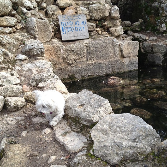
Perhaps the richest area with the most number of hikes close by Jerusalem is the Sataf Forest. We’ve picked three outstanding trails in this area. The first – and easiest – is the extremely popular 7-kilometer loop that circles Har (Mount) Eitan. At the cooling end of a hot summer day, this wide dirt road is often packed with hikers, bikers and joggers. Run it in under an hour, or walk it in two and a half.
The trail is not particularly shady, but the payoff is the views – a 360-degree panorama, from the hills and small moshavim toward Modi’in and Tel Aviv to the west, to the hulking Hadassah Medical Center-Ein Kerem to the east. Leave your car in the Sataf parking lot and walk slightly back down the road on which you entered to find the start of the hike. You can’t get lost – just keep going in a circle until you come back to the parking lot (the final stretch is a climb through a wooded picnic area). If it’s late in the afternoon, go the other direction to catch the setting sun.
2. Kibbutz Tzuba (Tzova), 2.5 hours
Our second Sataf-area hike starts on the Har Eitan trail, but takes a quick turn to the right at the sign for the Israel Trail. Inaugurated in 1995, the 620-mile Israel Trail was stitched together from the best of Israel’s existing trails. At the turn, the trail descends steeply and the loose dirt and rocks can be tricky to navigate, but soon you’ll be on a flat jeep trail that veers to the left before climbing up to Road 395. Cross the two-lane highway and head into Kibbutz Tzuba (also called Tzova), home of the famous kiddie amusement park Kiftzuba.
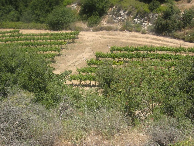
Leave the Israel Trail to enter the kibbutz. Once inside, pass the park and follow the signs to Ein (Spring) Tzuba. At the large OSG factory building, turn right and follow the red path (slightly left) into the vineyards of the Tzuba Winery before eventually meeting up with the green trail. Be careful not to miss the spring (the signage points from the opposite direction), a charming oasis built around the source of underground water that gives the area its name. There is a grove of trees with picnic benches and lots of grass, with the vineyards just outside. The trail eventually returns you to Road 395, where you can walk back to your car by way of the Sataf area grounds. Look for the blue trail a few meters along the road that winds back to Jerusalem.
If archaeology is your thing, the 12th century Crusader fortress known as Belmont is nearby. At the OSG factory junction, go straight toward the mountain instead of making the right.
3. Sataf to Ein Kerem, 2.5-3 hours
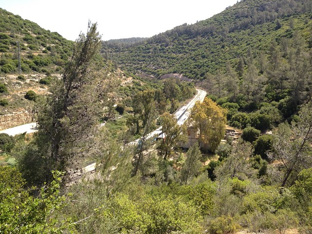
Our last hike from Sataf is also on the Israel Trail, going in the other direction. This is a two-car hike; park one car at Sataf and follow the signs downhill to Jerusalem. The Israel Trail affords some spectacular views on the way to Nahal Sorek, a wide flat valley (nahal is Hebrew for “dry riverbed”) that gently winds toward the Jerusalem village of Ein Kerem. The nahal route splits from the Israel Trail. (If you miss the turn, you’ll end up near Ein Hendek, also a pretty route, and the start of our next hike, but not where you parked your second car!)
Nahal Sorek eventually meets up with Road 395. At the beginning of the hike, when you’re driving out of Jerusalem toward Sataf, turn right toward the Ein Kerem Agricultural School. You may park in a dirt lot immediately to your left.
4. Shvil HaMa’ayanot, 2.5 hours round trip
You can’t go wrong on the Israel Trail, and Shvil HaMa’ayanot is both breathtaking and brief (just 3 kilometers). It’s not a loop, but at only an hour or so in each direction, you won’t regret returning on the same path. The starting point is on the road that leads between Hadassah Medical Center-Ein Kerem and Moshav Even Sapir. You can visit Ein Hendek, a popular picnic spot and spring at either the beginning or end of the hike; it’s about a 15-minute walk.
Shvil HaMa’ayanot gets its name from the many springs (ma’ayanot) along its way. You can stop at each one and even go for a dip in some. There are tunnels and views into the Judean Hills the entire length of the tiyul, which proceeds through pine, oak, carob and olive trees. You end up at a picnic spot with tables and shade just down the hill from Yad Kennedy. Eat your lunch here before returning the way you came.
If you have time, walk up the hill to Yad Kennedy, a striking memorial to US President John F. Kennedy. The Sa’adim ruins – remains of a Byzantine-era agricultural farm – and Sa’adim Spring are also worth exploring at your leisure.
5. Nahal Katlav, 3.5 hours
This lovely trek starts at the Bar Behar restaurant and ice-cream stand, a short drive from Jerusalem in the Bar Giora area (the restaurant is on the road to Nes Harim). The path descends, winding past a spring until you reach the nahal itself, a relatively short jaunt at less than an hour. While there’s no water in the nahal, it’s very shady. In the spring and summer, watch out for flies!
Eventually, the trail reaches the Bar Giora train station, long abandoned and out of use, but the train between Jerusalem and Tel Aviv will often pass while you stop to eat your lunch here. After the station, the trail climbs steeply, passing an abandoned Arab village before looping back to the starting point. You can settle down at the end with an ice cream or artik (popsicle), especially welcome in the hotter months.
6. Hirbet Itab, 3.5 hours
A second loop hike in Bar Giora is just across the road from the Bar Behar restaurant. The main attraction here, beyond the beautiful views and vineyards you pass, is the impressive Hirbet Itab ruin, a 12th century Crusader-era fortress.
Start by taking the red trail to a spring that feeds a small pool (don’t be surprised if it’s dry) and then onward to the fort. After climbing the fort or eating your picnic lunch by the ruins, continue on the red trail steeply down the other side of the hill into the valley, then turn left on the green jeep trail. It will run into a blue trail and after an hour or so you’ll be back at the Bar Behar parking lot.
If you have two cars, you can extend this tiyul by continuing on the red trail toward the end point at Moshav Zanoach near Beit Shemesh. This will take you past the Cave of the Twins, one of Israel’s leading “bat caves.” The cave is closed when the bats are hibernating (usually November to March), but at other times of the year, you can go inside – if you dare. Bring a flashlight to see what’s lurking above.
7. Nahal Kesalon, 2.5 hours from Shoeva;3.5 hours from Tzuba
If, on the hike from Sataf to Kibbutz Tzuba, you wondered what would have happened if you had continued on the Israel Trail, here’s your answer. You can start at the kibbutz, or for a shorter hike, drive down Highway 1 and park at the gas station at the Shoeva junction. Either way, you’ll be walking through Nahal Kesalon. From the gas station, cross the street, make a left into the moshav and wind down the hill until you reach the start of the trail.
Nahal Kesalon is an easy walk on a wide dirt road with tall canyon walls on either side. It’s not particularly varied – you won’t have rock climbing or vistas – but near the end you come out into the Martyr’s Forest, established by the B’nai B’rith organization to commemorate Holocaust victims. The trail ends near the Eshtaol junction on Highway 38, which is where you’ll have parked your second car. You can also catch bus 415 or 446 back up Highway 1 to Shoeva.
Bonus: At the Eshtaol end of the hike is the kosher boutique Flam Winery, where you can buy a bottle or two to reward yourself for a trek well done.
8. Hirbet Hanut to Ein Kobi, 4 hours
For the next two hikes, we pick up the Israel Trail in a different part of the Jerusalem area – from Road 375, which runs between Gush Etzion and the Elah Valley, south of Beit Shemesh. (You can also get to Road 375 via the road that connects Hadassah-Ein Kerem and Bar Giora.) The Elah Valley is the location of the biblical battle between the Israelites and the Philistines that culminated in the battle between David and Goliath.
Head first to Begin Park and follow the signs to Ein Kobi (Kobi Spring). Park one car there and in the other continue another 8 kilometers until Hirbet Hanut, a pretty picnic area at the spot of a sixth-century Byzantine church that made the news a few years back when its intricate ancient mosaics were destroyed by vandals.
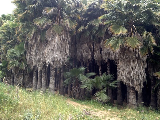
You’ll be walking back on the Israel Trail from Hirbet Hanut to Ein Kobi. The route winds behind Moshav Matta (almost close enough to peek into some of the residents’ windows) as well as Moshav Mevo Beitar. The scenery is remarkably varied, including rock climbing, a fragrant pine forest and even an unexpected palm grove. On a hot day, take a dip in the Kobi Spring. There are some Byzantine-era ruins here too.
9. Derech HaKaiser (the Caesar’s Route), 90 minutes
For this 3.5-kilometer trek, you also start at Hirbet Hanut, walking in the opposite direction and ending at another picnic spot called Beit Bad. It’s nicer with two cars because otherwise you have to return on the same route and it’s all uphill.
This part of the Israel Trail is known as Derech HaKaiser – the Caesar’s Route – and was built by the Romans to facilitate travel with their armies and horses toward Jerusalem. You’ll pass over ancient hewn steps in one section of the road. At the Beit Bad end, there is a reconstructed Roman-era wine press. Archaeologists believe the road was built in 130 CE in honor of the visit of Emperor Hadrian.
Derech HaKaiser parallels Road 375 from above and can get a little noisy from the traffic below, but the surrounding forest makes up for it. Warning: the trail from Hirbet Hanut veers off to the left early on; if you’re not paying attention, you could miss it.
10. Givat HaTourmasim, 3 hours
As long as you’re on Road 375, continue driving another 15 minutes to Givat HaTourmasim, a hill that fills up with thousands of families out to see the deep purple lupines (tourmasim) that bloom for only about three weeks around Purim time. The hike up the hill takes just 10 minutes, but there’s another tiyul in the area that lasts much longer and is worth doing at any time of the year.
Walk through the parking area until you see a black trail to the right that heads steeply up the hill. (It’s shorter than it looks.) The trail affords some great, unimpeded views of the Gush Dan area. When the trail splits, follow the green markers to the left. You’ve already achieved the trek’s elevation, so now you can just enjoy the walk. The green trail eventually meets a blue trail, which takes you back to Givat HaTourrmasim from a side most visitors rarely see.
More on Life


Fighting for Israel's truth
We cover what makes life in Israel so special — it's people. A non-profit organization, ISRAEL21c's team of journalists are committed to telling stories that humanize Israelis and show their positive impact on our world. You can bring these stories to life by making a donation of $6/month.