By learning from history, a new Israeli invention promises to help pinpoint where and when earthquakes will strike again, minimizing danger to lives and property.

As Japan continues to pick up the pieces after last week’s devastating earthquake and tsunami that are likely to have killed over 10,000 people, left hundreds of thousands homeless, and threatened a nuclear catastrophe, Israeli geologists have unveiled a new tool that allows researchers to learn critical lessons for the future by understanding patterns of seismic activity in the past.
Developed by Prof. Shmuel Marco of Tel Aviv University, the tool, which he calls a “fossil seismograph”, examines geological formations to find historical patterns of earthquakes reaching far back into the ancient past.
With this information, experts can better predict where and when earthquakes, like the destructive 8.9 earthquake that hit Japan, may occur again – and take measures to prevent more catastrophic damage.
“Current seismographical data on earthquakes only reaches back a century or so,” says Marco, whose latest research was published in the journal Geology. Most earthquake activity takes place on a longer cycle, sometimes of several hundred years, so 100 years of information just isn’t enough for predictive purposes, he explains.
Mud can be revealing
“Our new approach investigates wave patterns of heavy sediment that penetrate into the light sediments that lie directly on top of them. This helps us to understand the intensity of earthquakes in bygone eras – it’s a yardstick for measuring the impact factor of earthquakes from the past.”
Marco began developing the seismograph, which can be used in areas where earthquakes affect large bodies of water like lakes or seas, after observing a strange “wave” phenomenon in disturbed sediment in the Dead Sea region.
Marco, along with his colleague Prof. Eyal Hefetz and doctoral student Nadav Wetzer, found that the layers of mud in the Dead Sea were originally stratified in a very stable manner, but now heavier sediment appears to have been pulled up into the lighter sediment – presumably the result of seismic activity, since earthquakes cause deformation in rocks and sediment.
Using a combination of physics and geometry principles, the researchers were able to analyze the deformation of sediment caused by past earthquakes and calculate how past earthquakes were distributed in scale, time and place. How the deformation process advances depends on the strength of the earthquake – the stronger the trembler, the more intense the deformation.
When will an earthquake strike again?
When and where the next big quake will hit is a question that has captured Marco’s attention for a long time.
In his previous research on the history of earthquakes in the Middle East as a predictor of the future, Marco delved into hundreds of ancient manuscripts, many of which were written by Christian and Muslim clerics, to determine that a series of major earthquakes hit the Jordan Valley over the past 2,000 years.
He told ISRAEL21c that an interval of about 400 years separated each significant earthquake until the last one, almost a thousand years ago. This unusually long interval means that a great deal of tension has been building along the fault line, and may be released at any time in a potentially devastating earthquake in the region.
If danger zones can be pinpointed accurately before hand, however, it can help engineers ensure that all new buildings in the vulnerable areas are quake proof, and that old ones are fortified accordingly.
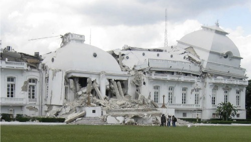
As last week’s devastation in Japan, and the catastrophic earthquake in Haiti a year earlier, proves only too well, the need to predict where and when an earthquake might hit is vital information for countries as far apart as Israel, the Middle East, Asia, and the United States.


