


Combining a drone-mounted sensor with analytic software, the Israeli company Sensilize is launching what it calls the future of precision agriculture.
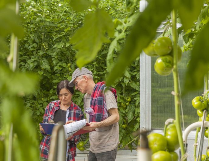
The emerging field of precision agriculture is based on observing, measuring and responding to crops with smart technology. Drones — also called unmanned aerial vehicles (UAV) or unmanned aerial systems (UAS) – are giving farmers new possibilities, such as crop-dusting without a plane, but can also be integrated with smart technology.
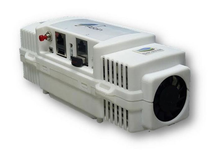
Sensilize uses a micro-UAS platform to map fields with an integrated application-driven sensor called Robin-Eye, whose eight-band calibrated sensor provides ultra-high-resolution multispectral images of vegetation in almost all light conditions.
Sensilize’s cloud-based Robin-Mind software automatically analyzes these images and then – within 24 hours — provides the farmer with a true color image of the area as well as interpreted maps to enable optimal decisions to enhance efficiency, maximize yield and minimize resources.
Sensilize was founded at the beginning of 2013 by Yoav Zur and Robi Stark, who have doctorates and nearly 20 years of experience in environmental remote sensing and mapping of vegetation, soil and water quality. Their previous remote sensing-based company was acquired by Elbit Systems in 2008. After leaving Elbit, they spent a year meeting with agronomists in Israel and other countries to pinpoint market needs before founding Sensilize.
“Our background is in remote sensing, not agronomy or aviation,” Stark explains to ISRAEL21c. “We are bridging the gap between engineers and users.”
The first generation of the Robin system (the sensor and the analysis software) is now in pilot trials through partnerships with big farming and research operations. These trials will provide Sensilize with valuable feedback from actual users before the final version of the system is introduced to the global market in June, says Stark, who was at Israel’s annual AgriVest ag-tech conference on April 27.
Agriculture and utilities
It’s not only farmers who are driving early sales of the Robin system.
“One of the big markets using vegetation mapping is the utilities industry,” he says.
“Utility companies spend millions on maintenance, and they need a more efficient way of determining when to trim foliage growing near their infrastructure. So we already have two clients in Europe, one mapping highways and another mapping railroads. Between agriculture and utilities, we have requests coming from all over.”
Stark says Sensilize is positioned to fill a gap in advanced vegetation mapping by providing and analyzing key data. “We take it from A to Z, from data collection to analysis and, most importantly, how to manage and distribute the data. Part of Robin-Mind is web-based management software addressing the needs of the user and flight operator.”
He believes the company’s uniqueness lies in the scientific background of its team. “Yoav and I have both made mistakes and had a lot of successes in the past, and we have put everything we’ve learned along the way, all our knowhow and experience, in all aspects of our system,” he says.
Over the course of the first six months, they developed their prototype and tested it in Israel, Canada, and Sweden. The current product has been tested in Israel, Chile, the UK, France, and soon in South Africa and the United States.
https://www.youtube.com/watch?v=HtIWq4EHWqo
Right now, Robin-Eye employs a 600-gram, eight-band multispectral sensor capable of mapping all the reflected color pigments that tell the story of vegetation condition. Remote sensing systems rely on light energy that is either diffusely reflected (scattered) or emitted from the surface being monitored.
“Most systems used in agricultural imaging today are digital cameras, not calibrated sensors. With calibration, one can fly on a sunny day or a cloudy day and compare data over the long term to map trends and disease,” says Stark.The user can select the most appropriate time to acquire the imagery.
The system is built in Israel of mainly off-the-shelf components and Israeli-developed software. Robin is open to accept and share with additional and external datasets.
“Our main focus is the user; simplicity, practicality, and availability have been taken into consideration from the design stage while keeping a cost-efficient solution in order to provide significant value to the user,” he says.
Sensilize is one of many promising Israeli companies getting the attention of investors in agriculture technology.
For more information, click here.
More on Earth
 in the newly reopened Nahal HaShofet park. Photo By Alex Kolomoisky/KKL-JNF")


Fighting for Israel's truth
We cover what makes life in Israel so special — it's people. A non-profit organization, ISRAEL21c's team of journalists are committed to telling stories that humanize Israelis and show their positive impact on our world. You can bring these stories to life by making a donation of $6/month.