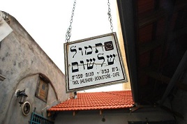
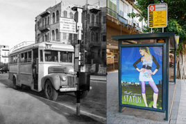
Jerusalem has a new urban plaza for tourism, events and entertainment. The intersection of Shlomzion HaMalka, Ben Sira and HaMelech Shlomo Streets has been redesigned, paved, landscaped, furnished and turned into a square that connects pedestrian traffic from the city center with the Mamilla open air mall and the Old City at Jaffa Gate. The intention of the NIS 18 million project, according to the Municipal Spokesperson’s office, is to “pave the way to tourist business and increase the economic boom in the city center.
The inauguration of the new square was held this past Thursday in the presence of Mayor Nir Barkat, while just up the street at the Russian Compound, the Jerusalem Indie City street music festival was happening. There was nary a mention of Bevingrad, even though a scant 65 years earlier (a mere eyeblink in historical terms), that was what the entire area between these two points was called.
“Bevingrad” was the name cynically given by Jerusalem residents during the British Mandate. It referred to areas of Jerusalem that were fortified by the British for fear of Etzel (Irgun) attacks — like one carried out at the Kind David Hotel in 1946 and included buildings on King George Street, the Russian compound (which the British had rented from the Russians to use as a jail), police headquarters and courthouses, the Italian hospital, the central post office, buildings owned by companies British company OBG and Italian Insurance Company Generali, as well as police storage warehouses. The nickname referred to British Foreign Secretary Ernest Bevin and the famous Stalingrad fortifications.
Bevingrad was taken over in 1948 during the War of Independence. The Haganah and Irgun executed an operation known as Kilshon in which the Jewish forces commandeered British installations as the British army evacuated Palestine on May 14-15 1948, so as to connect isolated Jewish communities in southern Jerusalem with the rest of Western part of the city.
Between May 13-18, 1948, Haganah and Irgun forces executed Operation Kilshon (the name means “pitchfork”, referring to the three pronged attack from the north, center and south). According to Wikipedia, “The Yishuv forces quickly managed to capture ‘Bevingrad’… Many members of the Jewish underground had been imprisoned there. They also captured the Notre Dame Church, the American Colony, Sheikh Jarrah, Talbiya, German Colony, Baka, Talpiot and the Greek Colony. A large portion of what was captured was to become the Israeli controlled portion of Jerusalem – ‘West Jerusalem'”.
From then and until 1967, it was the walled-off edge of “no man’s land” on the border of a Jerusalem divided between East and West .
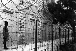
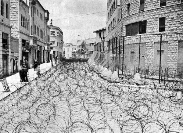 This is what it looked like in 1948. This is the uphill view of Princess Mary Avenue — now Shlomzion HaMalka Street. The British Mandatory administration used barbed wire to block the area from both Jewish and Arab traffic. The building on the right is the Generali building, which served as police headquarters.
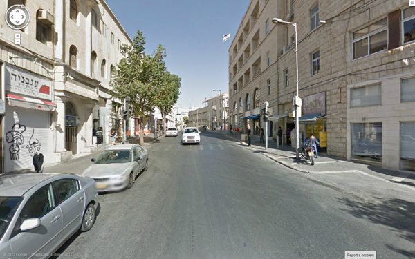
Here’s the Google Streetview from 2011…
 And here’s the new “Shlomzi” square today. More evening music and street theater happenings are scheduled for August 15.
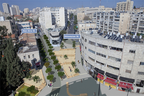 The 1948 photo was taken by Hanna & Efraim Degani who ran the Photo Prisma shop in Zion Square. According to a memorial website dedicated to their work, Efraim Degani was “Born in Berlin and forced to emigrate in 1933, after two years of studying medicine. Studied medical photography in Italy for two years, then made aliyah to the Land of Israel in 1935. At first he worked as a medical photographer for the Hadassah hospital. In 1944 he took over, together with his wife Hanna, the recently opened shop Photo-Prisma in the center of Jerusalem. During the 1950s he was photographer for the Foreign Ministry, and at the end of the 1960s he left Photo-Prisma to open the Photography Department at the Bezalel Academy of the Arts. In the 1970s he was Dean of Students at Bezalel for five years. He was loaned for two years to the Hadassah College in Jerusalem, where he founded the Photography Department.”
More wonderful Hanna & Efraim Degani photos documenting historic events are available here. Other “Bevingrad” photos are available at the Harvard University Library Visual Information Access collection. Photo of today’s Shlomzion Square: Mordagan Productions.


