

")
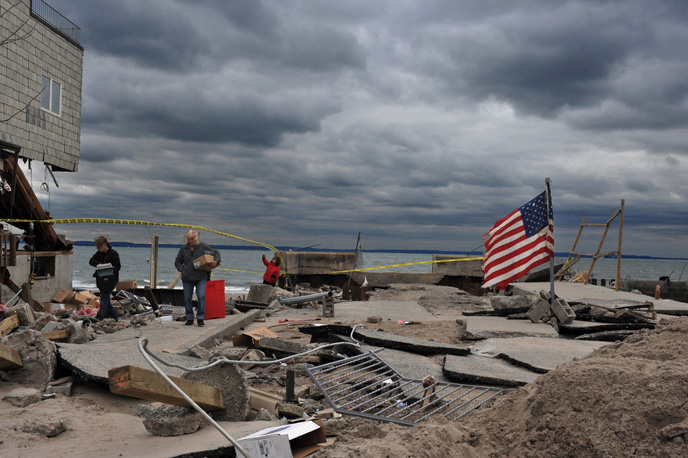
Can you imagine how much better prepared communities could have been before Hurricane Sandy, Hurricane Katrina and Hurricane Niklas made landfall, had the weather forecasters been able to predict these ferocious wind storms two weeks prior?
An Israeli study shows that 85 percent of the most intense hurricanes affecting the US and Canada start off as disturbances in the atmosphere over Western Africa.
“We found that the larger the area covered by the disturbances, the higher the chance they would develop into hurricanes only one to two weeks later,” said Tel Aviv University’s Prof. Colin Price of the Department of Geosciences at TAU’s Faculty of Exact Sciences .
Hurricanes require moisture, the rotation of the earth, and warm ocean temperatures to grow from a mere atmospheric disturbance into a tropical storm.
Using data covering 2005-2010, Price – together with his graduate student Naama Reicher — analyzed images of cloud cover taken by geostationary satellites, which orbit the Earth at the precise speed of the earth’s rotation and take pictures of cloud cover every 15 minutes. This enabled them to track the variability in cloud cover blocking the earth’s surface in West Africa between the months of June and November — hurricane season.
“We first showed that the areal coverage of the cold cloud tops in tropical Africa was a good indicator of the monthly number of atmospheric disturbances — or waves — leaving the west coast of tropical Africa,” said Price. “The disturbances that developed into tropical storms had a significantly larger area covered by cold cloud tops compared with non-developing waves.”
According to Price, only 10 percent of the 60 disturbances originating in Africa every year turn into hurricanes. And while there are around 90 hurricanes globally every year, only 10 develop in the Atlantic Ocean.
“We wanted to know what was so special about these 10% of disturbances that develop into hurricanes. Was there something different about these storms at their genesis?” said Price. “By looking at each of these storms individually, we found again that the larger the cloud coverage originally in West Africa, the higher the value of the accumulated cyclone energy in a future hurricane. The conclusion, then, is that the spatial coverage of thunderstorms in West Africa can foretell the intensity of a hurricane a week later.
“If we can predict a hurricane one or two weeks in advance — the entire lifespan of a hurricane — imagine how much better prepared cities and towns can be to meet these phenomena head on,” Price said.
More on News